March 31: The second Thames day

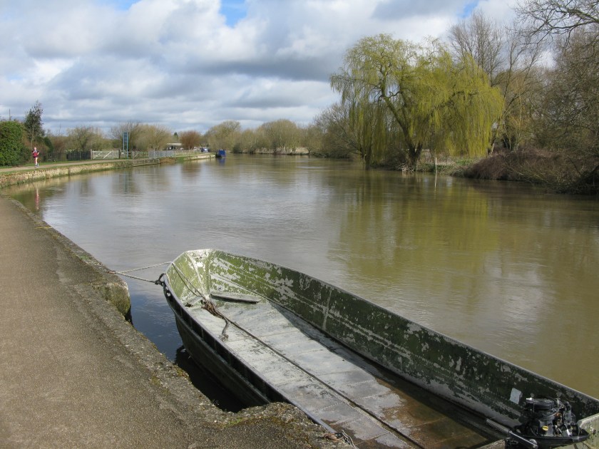
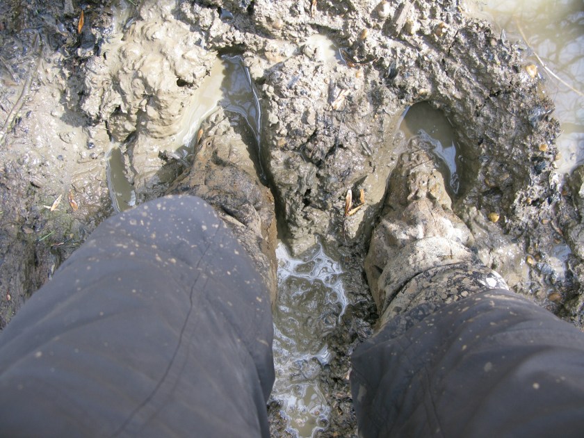
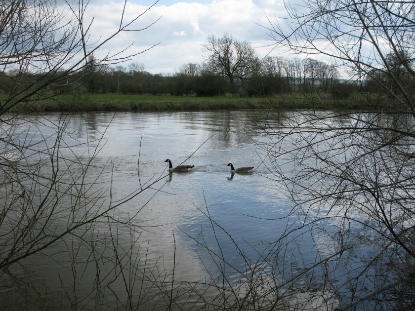
I decided to take today as a shorter day. I’ve had some long days recently, and I wanted to give my body a chance to recover. I still managed to rack up some progress, but I suspect that I had an easier day than these two, who were heading against the flow of the river.

IMG_3134

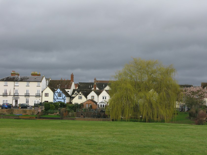
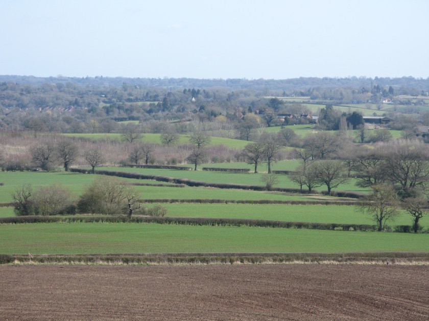
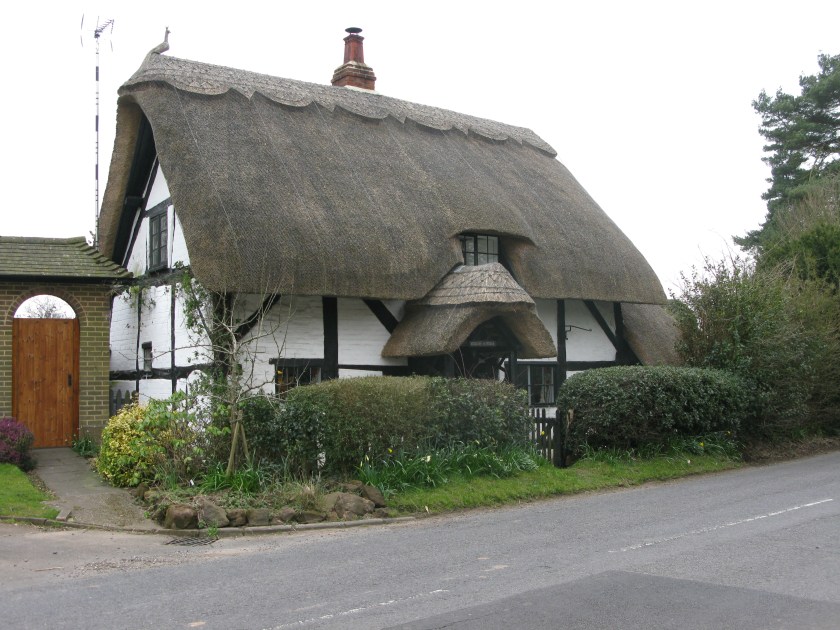
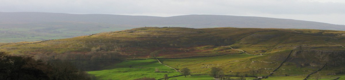
One thing that this walk has taught me is how lucky I am to live where I do, in the Yorkshire Dales with the South Pennines, Forest of Bowland, and the Lake District all within a short drive from my doorstep. I’ve only spent two days walking alongside the Thames, and have a few days more to go, but the sameness is starting to wear on me. The Thames Valley is rich farmland with pretty villages and a long history, but the opportunities for walking are quite limited and there isn’t a lot of variety in the landscape. At home there are attractive villages and farms, but also high fells, wild moors, lush valleys, limestone, gritstone and volcanic rock, and a seemingly endless range of opportunities to enjoy it all.

“The North” is often characterized as a disadvantaged part of England. Economically that may be true, but not when it comes to spending active time outdoors. I’m glad I’ve now walked in this part of England, but I won’t rush back.

Route: Dorchester to Streatley via Thames Path. Terrain: riverside paths, meadows. Weather: warm, partly cloudy. Daily distance: 17.3 km/10.7 miles. Cumulative distance: 511.0 km/316.8 miles. Accommodation: The Bull, Streatley.

March 30: The first Thames day

Today, and for the next several days, my route runs alongside the Thames.

IMG_3106

I haven’t taken many detours off the route so far, but I made an exception today to visit the ancient churchyard at Sutton Courtenay, just south of the Thames.

IMG_3119

Eric Blair, better known by his pen-name of George Orwell, is buried here. While he is best-known for Animal Farm and Nineteen Eighty-Four, it is his non-fiction and essays that I enjoy most. His best writing is characterised by close observation, careful analysis, and clear and precise language. It’s also lightened by a love of nature and of the simple pleasures of everyday life. A good example is his essay “Some Thoughts on the Common Toad”, which is one of my favourites.

Orwell once wrote that “good prose is like a window pane”. I think what he meant is that the best writing allows the meaning to come through so clearly and simply that the reader becomes unaware of the writer’s craftmanship. It’s a demanding standard.

He has a simple headstone in a quiet corner of the churchyard.

IMG_3113

If you look closely you’ll see that someone, in a fitting tip of the hat to one of his most famous essays, has left him a nice cup of tea.

Day 20 Route: Oxford to Dorchester via Thames Path. Terrain: riverside paths. Weather: mix of sun and cloud. Daily distance: 30.4 km/18.8 miles. Cumulative distance: 493.7 km/306.1 miles. Accommodation: George Hotel, Dorchester.

March 29: The Oxford day

There are no pictures of gleaming spires to accompany today’s blog. I had planned to take some when I reached Oxford. However, as I approached the city, the rain that had started earlier was getting heavier. Even the goslings were taking shelter.

IMG_3111 (0)

By the time I arrived in Oxford, the rain was bucketing down – the hardest that I’ve had so far on this walk.

It struck me, afterward, that I must have looked a slightly odd figure on the very urban streets of Oxford. I was dressed for grubbing around in the countryside: walking boots, gaiters, cargo pants, travel shirt, and today a mountain waterproof, liberally spattered with mud. I was carrying a big pack, complete with drying socks hanging off it, and the various bits of kit that are always close to hand – camera, map case, hydration tube, and trekking poles. And I was no doubt wearing the look of grim determination that is generally my mindset by the end of a long day.

If people were wondering if I were lost, they were kind enough not to ask. Or perhaps the look of determination put them off.

Day 19 Route: Charlbury to Oxford via Oxfordshire Way and Oxford Canal Path. Terrain: field paths, towpaths. Weather: initially sunny, but raining increasingly hard later. Daily distance: 34.2 km/21.2 miles. Cumulative distance: 463.3 km/287.2 miles. Accommodation: Ridings Guest House, Oxford.

March 28: The milestone day

Today was a milestone day for three reasons.

First, sometime today, I passed the halfway point between my starting point and Canterbury. While the English leg of my trip is the shortest leg, the fact that I am now more than halfway through this leg still feels significant.

Second, I turned left. Up to today, my journey had taken me generally southward. Today, and from now on, I head generally eastward, aiming more directly for Canterbury.

Third, I passed the test. Today was a very tough day. Not only was it the longest day so far, but the going was tough. Most of the day was spent going along a broad river valley that had clearly had a lot of rainfall in recent days and weeks. At best, the ground was wet and slippery – there were any number of times that only my poles kept me from taking a tumble. For long stretches, the trail had deteriorated into bog, with the mud ankle-deep or worse.

wp-1459197142036.jpg

In some places the trail had completely flooded (yes, that is a trail marker).

image

But partway through the day I realized, with some surprise, that I was coping physically and mentally in a way that I could not have done even a couple of weeks ago. This journey is changing me, making me both fitter and more resilient. No doubt there will be tougher challenges along the way, but I can face that prospect with more confidence now.

Rome suddenly seems much closer than it did a day ago.

Day 18 Route: Stow-in-the-Wold to Charlbury via Heart of England Way and Oxfordshire Way. Terrain: river valley; field paths , tracks and roads. Weather: sunny with blustery winds. Daily distance: 34.5km/21.3 miles. Cumulative distance: 429.1 km/266.0 miles. Accommodation: The Bell, Charlbury.

March 27: The Cotswolds day

Today I was walking across the Cotswolds, which is officially an Area of Outstanding Natural Beauty. However, the real beauty of this landscape isn’t its natural features. It’s the softly golden stone that has been used for hundreds of years for building in this area. So, no deep thoughts today, just some pictures to enjoy. Happy Easter.


Route: Mickleton to Stow in the Wold via Heart of England Way. Terrain: rolling hills; field paths, tracks, and roads. Weather: blustery with a mix of sun and showers. Daily distance: 23.4 km/14.5 miles. Cumulative distance: 394.6 km/244.7 miles. Accommodation: The Grapevine, Stow on the Wold.


March 26: The first stormy day

Today was my first stormy day, with gusty wind and showers blowing through.

IMG_3060

Fortunately I had a short day planned, by luck rather than judgment. I’m entering the Cotswolds, a pretty and popular part of England, and it’s Easter weekend, so accommodation has been difficult to find. Today was short, but tomorrow and particularly Monday will be long days.

As I walked, I was thinking about Jo’s comments a few days ago about walking alone versus walking with others. While I enjoy walking with other people, I think in many ways it’s easier to tackle a long walk like this alone. Things like pace, how often to take rest breaks, how long to make the days, whether to talk or walk in silence, and so on, are very individual. It would be hard to find a walking partner who would be sufficiently compatible for four months.

As well, I find that I generally don’t get either bored or lonely when I walk on my own. The sights, sounds, and smells of the landscape are there to enjoy. There are always things to think about, whether it is practicalities like navigation or placing my feet, planning the day’s blog post, or simply letting my thoughts wander. Increasingly, as my body gets used to the routine of walking, the days seem to pass more and more quickly. And then there is the unique exhilaration that comes with hitting stride on a ridge or edge, alone in the landscape, and being able to see for miles.

I will actually have the best of both worlds on this walk. I have people planning to join me me on certain sections, which will provide some welcome company, but I’ll be doing most of the walk on my own.

And, as happened today, I could always pick up a few companions along the way

IMG_3063

Day 16 Route: Broom to Mickleton via Heart of England Way. Terrain: mostly flat; field paths. Weather: cool, windy, showers. Daily distance: 15.2 km/9.4 miles. Cumulative distance: 371.2 km/230.1 miles. Accommodation: Three Ways House Hotel, Mickleton.


March 25: The Shakespeare day

We don’t know many details about Shakespeare’s daily life. Oddly, we do know where he was, and what he was doing, exactly four hundred years ago to the day today: he was in Stratford-on-Avon, just a half-dozen miles east of where I am now, finalising his will.

I didn’t go through Stratford, or visit any of the honeypot Shakespearean attractions, but he would have known the landscape through which I walked today, just north and west of Stratford. The Forest of Arden that he mentions in some of the plays no longer exists, except in small thickets. The fields and the landscape, however, cannot have changed that much from the countryside he would have known as a boy, and to which he retired to live late in his life.

IMG_3049IMG_3053

For me, geography and history enrich one another: places are more interesting for knowing the times and events they have seen, and history is more tangible when standing where it happened. I suppose that is one reason why I chose the Via Francigena for a long walk. There is, perhaps, no other walk in Europe with such a rich historical context.

Route: Henley in Arden to Broom via Heart of England Way. Terrain: rolling farmland and small woods; mostly field paths. Weather: sunny and warm, clouding over later. Daily distance: 19.9 km/12.3 miles. Cumulative distance: 356.0 km/220.7 miles. Accommodation: Broom Hall Inn, Broom.


March 24: The first rainy day

The most famous pilgrimage story in English mentions showers in its first line. So, I had about six hundred years’ warning of today’s weather.

It started almost imperceptibly, with tiny intermittent drops that I told myself that I was imagining. Then it got to the point that I could clearly see spots on my shirt, and cold delude myself no longer. By midmorning, it had settled into a persistent drizzle that lasted for the rest of the day’s walk.

Oddly, I found that I didn’t mind the rain. It wasn’t hard enough to limit visibility and make navigation difficult, and I have good wet-weather gear so I was able to stay warm and dry. And knowing that I would have a roof over my head at the end of the day made coping mentally so much easier – it would have been a different story if I had known I would be setting up a campsite at the end of the day. If anything, today’s rain was a confidence booster, showing me that adverse weather, like fatigue and aches and pains, is something that I have the physical and mental resources to push through.

This part of England is well-supplied with wonderfully well-preserved period properties, but the manor house at Baddesley Clinton, now owned by the National Trust,  stands out as special. It’s not just the buildings – the fields around it have a wonderful feeling of timeless tranquility.

The photos don’t do it justice. I blame, of course, the rain.

Day 14 Route: Balsall Common to Henley in Arden via Heart of England Way. Terrain: rolling countryside; field paths, tracks, and roads. Weather: cool, light breeze, rain from midmorning on. Daily distance: 19.9 km/12.3 miles. Cumulative distance: 336.1 km/208.4 miles. Accommodation: Best Western, Henley in Arden.  Continue reading “March 24: The first rainy day”

March 23: The relatively hard easy day

If yesterday was the relatively easy hard day, then today was the relatively hard easy day. The walk seemed to be an interminable slog from field to field (there were over sixty – I went back to the map and counted).

The biggest problem with going from field to field is that it’s impossible to get any rhythm going. Up on the moors, or on good tracks like yesterday, you can hit stride and the miles seem to fly by almost effortlessly. Today, by contrast, I seemed to stop every few minutes to negotiate another gate or stile, and to check the map to see where on the far side of the next field I needed to aim. Imagine running a half-marathon where you have to stop every 300 metres to stop for directions, and you’ll have some sense of my frustration.

And then, near the end of the day’s walk when my mood was at its foulest, I came to the edge of Meriden with its simple Norman church and, just across the lane,  Moat House which is more than 400 years old and still someone’s home.

I spent a contented few minutes wandering the churchyard and enjoying the ambiance of a scene that would have changed very little since Shakespeare’s time.

And, just a couple of miles further on, I saw my first thatched cottage of the walk.

IMG_3032

This may be difficult countryside for the walker,  but it has its consolations.

Day 13 Route: Whitacre Heath to Balsall Common via Heart of England Way. Terrain: gently rolling fields. Weather: overcast, mild. Daily distance: 23.3 km/14.4 miles. Cumulative distance: 316.2 km/196.0 miles. Accommodation: Haig’s Hotel, Balsall Common.


March 22: The relatively easy hard day

I generally have an idea how tough a given day is going to be when I set out, as my maps give me an idea of the distance I have to cover and the terrain. But so much is dependent on the conditions on the ground: whether the ground is muddy, whether there are routefinding problems, whether there are lots of stiles, whether a field is short grass (bliss) or recently ploughed and tough going, and so on. Those are details that only become apparent through the day, but they make a major difference to the overall difficulty.

Today was a pleasant surprise: a day that I expected to be rather hard due to distance turned out to be easier than I had expected.  I knew I was in for mostly rolling farmland, and that is what I got.

IMG_3019

But the going was mostly on good tracks, the navigation on the ground was mostly straightforward (apart from the need to improvise a route around a field with what looked like a lone bull – a potentially dangerous situation), and I had an easier day than I expected.

Of course, ease is relative. I’ve been going at a quicker pace than I had anticipated, and my feet know it and are protesting – by the end of the day, every footfall hurts. Fortunately,  because of the difficulties finding accommodation over the Easter weekend, I have some shorter days coming up.  That should let me put my feet up, literally and figuratively, much earlier in the day.

The saving grace on the tough days has been the “full English”, which I’ve been able to get most mornings.

IMG_3013

It may be a dietician’s nightmare, but it’s the ideal start for a day’s walk. Helpfully, it takes care of any need to worry about lunch: with a couple of granola bars through the day, it will carry me through to dinnertime. As delicious as it is, I don’t think pain au chocolate will provide quite the same sustenance.

Day 12 Route: Lichfield to Whitacre Heath via Heart of England Way. Terrain: tracks,  roads, field paths. Weather: overcast, cool. Daily distance: 30.5 km/18.9 miles. Cumulative distance: 292.9 km/181.6 miles. Accommodation: Langley Cottage B&B, Whitacre Heath.