April 7: The dreary day

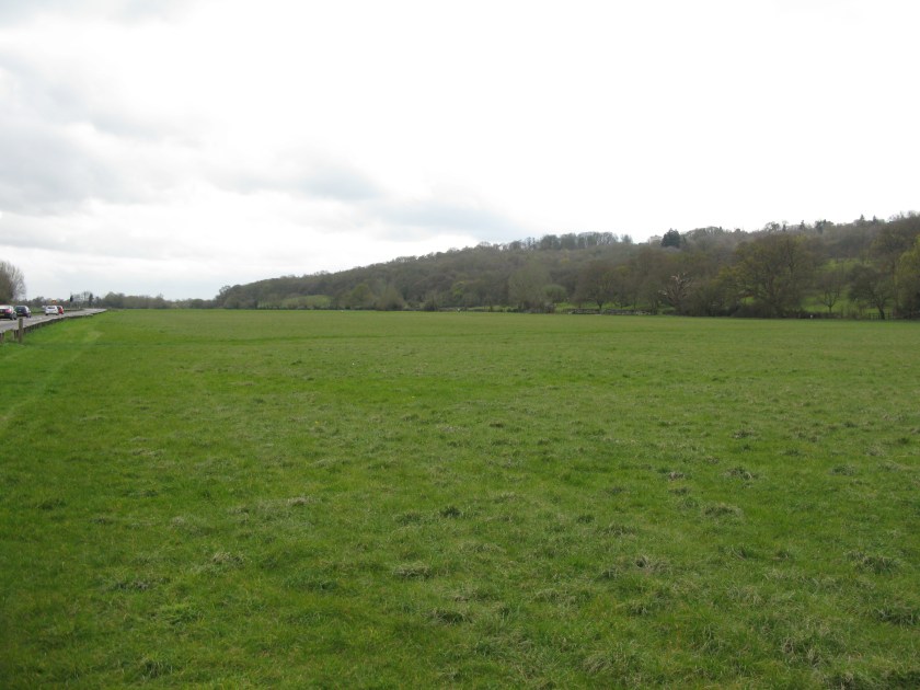
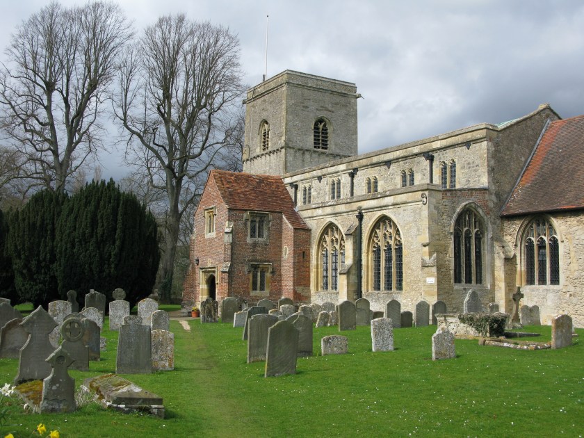
The weather today was the dreariest since the start of the walk: no heavy rain, but an intermittent drizzle that began as I left my hotel and continued on and off throughout the day.

Putting on my raincoat got me thinking about how little has changed between how I am equipped and how a pilgrim seven hundred years ago, or come to that a Roman legionary two thousand years ago on the same track, would have been equipped: sturdy footwear, an outer garment to keep out the weather, a warm layer, something to use as shelter, some money, some food and drink, a few personal effects, and a stout stick. The materials have evolved, but the basic needs haven’t. The priorities haven’t changed either: not getting lost, staying warm and dry, and reaching the day’s destination safely before nightfall. There’s an attractive simplicity to walking as a means of travel – you concern yourself with those most basic priorities.

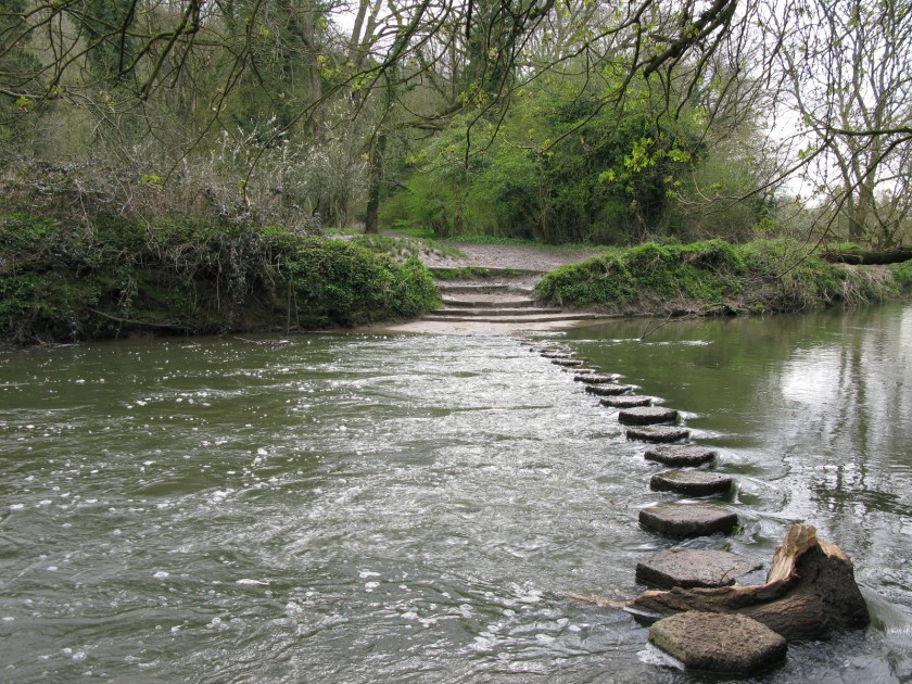
So, a dreary day, but one bookended by two pleasant surprises. First, shortly after setting off, I came to a stream crossing with a set of stepping-stones – once again, something that a pilgrim seven hundred years ago would have recognized as easier than building a bridge,  but rather less common nowadays.

IMG_3220

Second, coming down a narrow path near the end of the day, I found myself face to face with a fox just a few yards down the trail. No picture, sadly – by the time I got my camera out, he had disappeared.

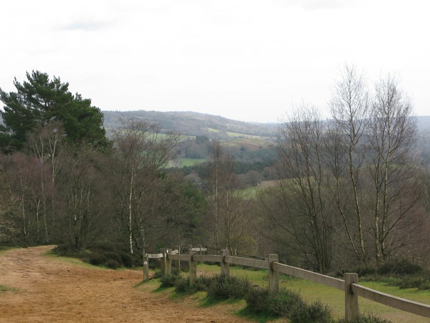
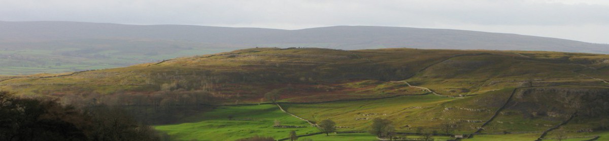
Day 28 Route: Dorking to Godstone via North Downs Way. Terrain: tracks through fields, woods and downland. Weather: overcast, intermittent rain. Daily distance: 25.5 km/15.8 miles. Cumulative distance: 653.6 km/405.2 miles. Accommodation: Godstone Hotel, Godstone.

April 6: The first North Downs day

I learned something about my taste in walks today.

My route took me away from waterways, which I’ve been following for the past week, and up onto the North Downs. The North Downs are a long ridge of hills that run west to east, just south of London. They are not particularly high, or particularly dramatic, but they lift a walker above the surrounding countryside – the route runs along the south side of the downs, just below the crest.

IMG_3207

And I loved it, mud, rain, wind, and all – and I had them all. I realized today that, as beautiful as the recent riverside paths have been, I tend to prefer walks that take you away from urban or cultivated landscapes, and ideally up into the hills.

Quite apart from the views, the Downs are replete with history. For the first time on this walk, I was following in the footsteps of pilgrims, as the North Downs Way runs near (and in some places along) the old pilgrim route from Winchester to Canterbury. The church of St. Martha, high on the ridge, would have served those pilgrims. It fell into disuse when the pilgrimages died out as there is no village near.

IMG_3204

And there are also signs of more recent history.

IMG_3215

In 1940, with invasion threatened after the fall of France, a line of “pillboxes” – simple fortification – was built along the North Downs. It would have been the last line of defence before London. In the event, there was a battle fought here, but it was fought in the skies above, no doubt watched from these pillboxes. And the invasion never came.

Day 27 Route: Guildford to Dorking via North Downs Way. Terrain: rolling hills, tracks. Weather: variable, from sun to heavy rain. Daily distance: 24.5 km/15.2 miles. Cumulative distance: 653.6 km/405.2 miles. Accommodation:  Lincoln Arms, Dorking.

April 5: The last towpath day

While I left the Thames behind yesterday, today my route followed a towpath again, this one along the River Wey. It was easy going, with the path just damp enough to soften the ground. For the first time since I left home, my boots are mostly free of mud. Still, after a week of walking on essentially flat land, I am looking forward to hills again.

I was thinking today about how a walk like this changes perceptions of distance. On one hand, “small” distances become large. If I have to walk a mile off route to reach accommodation, the trip there and back adds the better part of an hour to my day’s walk, although it would take minutes at most in a car. On the other hand, “large” distances become small. It continues to astound me that England, with all its history, population, scenery, and regional diversity, is so small that an ordinary person can walk almost from one end to the other in just over a month.

More signs of spring today: trees coming into leaf …

IMG_3197

… and frogspawn in puddles.

IMG_3190

Day 26 Route: Weybridge to Guildford via Wey Navigation. Terrain: towpath. Weather: sunny initially, showers and hail later. Daily distance: 22.8 km/14.1 miles. Cumulative distance629.1 km/390.0 miles. Accommodation: Travelodge, Guildford.


April 4: The last Thames day

I wrote yesterday about the sense of power and authority that emanates from Windsor Castle. But just a few miles down the road there is a rather unremarkable-looking meadow that has its own sense of history.

IMG_3183

This is Runnymede. Here, in the summer of 1215, King John signed the Magna Carta, accepting the principle that the Crown’s exercise of power would be subject to the rule of law. Many of the specific provisions of Magna Carta are now obsolete, but that central idea lives on.

As befits the birthplace of an idea, there are few monuments. It was a showery morning but, as I was leaving, the sun broke through and lit up the meadow. Fitting.

IMG_3188

Day 25 Route: Windsor to Weybridge via Thames Path. Terrain: riverside paths. Weather: intermittent showers. Daily distance: 24.0 km/14.9 miles. Cumulative distance: 606.3 km/375.9 miles. Accommodation: Ship Inn, Weybridge.

April 3: The Windsor day

Today I reached Windsor, with its famous castle.

IMG_3181

I didn’t go into the castle, as I didn’t arrive until late afternoon, but I did get a look at it from the outside. One thing I had not appreciated how massive Windsor Castle is. Even today, it dominates the town around it – it must have been a truly imposing sight in the days when royal power had real meaning.

Like Carcassonne in the Languedoc, it almost seems too perfect an example of a medieval castle to be true and, like Carcassonne, it is. The current castle has been restored repeatedly over the years, with many of those restorations long postdating the time when there was any real need for fortifications. But, for all the renovations, there is still a sense of both authenticity and authority.

IMG_3179

If Her Majesty ever decides to sell up, however, the listing will have to describe it as “ideal for insomniac aviation fanatic”. Windsor Castle sits only a couple of miles directly west of Heathrow, one of the world’s busiest airports, and Heathrow’s runways are aligned east and west. I had wondered why my hotel, which looks directly onto the castle walls, was so reasonably priced. I now know.

Day 24 Route: Marlow to Windsor via Thames Path. Terrain: riverside path. Weather: warm, mix of sun and cloud. Daily distance: 22.9 km/14.2 miles. Cumulative distance: 582.3 km/361.0 miles. Accommodation: Harte and Garter Hotel, Windsor.


April 2: The Henley day

Today took me along the Thames again, and through the posh and popular riverside town of Henley-on-Thames.

IMG_3156

There were quite a lot of people out walking near the town, and I ended up chatting with a few of them. One of the first questions I always get is where I am going, and the inevitable follow-up question is “why?”. My usual answer is to the effect that I wanted a project, which generally seems to satisfy people, but it did get me thinking about my motivations for this walk.

It is not a religious journey for me – I have always described the walk as “following a pilgrimage route”, rather than “going on a pilgrimage”. I have wanted for years to do a long walk in Europe. When I found out about the Via Francigena it seemed to be a good fit in a number of ways: it was long, it was through countries that I have enjoyed walking in, it had a unifying historical theme, and unlike the Camino del Santiago in Spain it was relatively unknown and so attracted few walkers. Adding the walk from my own home to Canterbury only seemed logical: it seemed incongruous to take a train to the start of a long walk, and walking would let me see parts of England that would be new to me.

But why a long walk at all? I enjoy long walks, particularly in the countryside: getting outside, being active, experiencing new places and revisiting familiar ones, dealing with the practicalities of navigation and the constraints of weather, terrain, and time. And there is something particularly satisfying about a long walk, where you can see footfalls on the ground turn into progress through the landscape – updating the map on the front page of this blog is always one of the high points of my day. There is satisfaction, too, in facing the challenges of a tired body and aching feet and simply carrying on, mile after  mile, hour after hour, day after day.

Ultimately, I suppose it comes down to challenge: setting an ambitious goal, seeing if I can achieve it, and learning about myself in the process.

Day 23 Route: Reading to Marlow via Thames Path. Terrain: riverside paths. Weather: sunny and warm to start, clouding over later. Daily distance: 29.6 km/18.4 miles. Cumulative distance: 559.4 km/346.8 miles. Accommodation: National Sports Centre, Bisham Abbey.


April 1: The Reading day

Today was my third day along the Thames, and once again there were gorgeous vistas along the river, helped by the fact that the landscape was more rolling this morning.

IMG_3141

While I might have grumbled a bit yesterday about the sameness of the scenery along the Thames, there is no doubt that the river passes through some very attractive countryside.

That fact was brought home to me, rather forcefully, when I arrived in Reading at the end of the day. The Thames Path runs very close to the centre of Reading, but they are worlds apart. I’ll admit that I’m spoilt, as for the last month I have not seen any cities up close, just country villages and market towns. But Reading, or at least its core, has a rather gritty feel to it. I suspect I’ll be seeing more such places over the next few days, as my route passes through the western periphery of London. I also suspect that I’ll be very glad when I find myself back out in the countryside.

Day 22 Route: Streatley to Reading via Thames Path. Terrain: riverside paths. Weather: initially sunny, clouding over later. Daily distance: 18.8 km/11.7 miles. Cumulative distance: 529.8 km/328.5 miles. Accommodation: Hotel Ibis, Reading.


March 31: The second Thames day

I decided to take today as a shorter day. I’ve had some long days recently, and I wanted to give my body a chance to recover. I still managed to rack up some progress, but I suspect that I had an easier day than these two, who were heading against the flow of the river.

IMG_3134

One thing that this walk has taught me is how lucky I am to live where I do, in the Yorkshire Dales with the South Pennines, Forest of Bowland, and the Lake District all within a short drive from my doorstep. I’ve only spent two days walking alongside the Thames, and have a few days more to go, but the sameness is starting to wear on me. The Thames Valley is rich farmland with pretty villages and a long history, but the opportunities for walking are quite limited and there isn’t a lot of variety in the landscape. At home there are attractive villages and farms, but also high fells, wild moors, lush valleys, limestone, gritstone and volcanic rock, and a seemingly endless range of opportunities to enjoy it all.

“The North” is often characterized as a disadvantaged part of England. Economically that may be true, but not when it comes to spending active time outdoors. I’m glad I’ve now walked in this part of England, but I won’t rush back.

Route: Dorchester to Streatley via Thames Path. Terrain: riverside paths, meadows. Weather: warm, partly cloudy. Daily distance: 17.3 km/10.7 miles. Cumulative distance: 511.0 km/316.8 miles. Accommodation: The Bull, Streatley.

March 30: The first Thames day

Today, and for the next several days, my route runs alongside the Thames.

IMG_3106

I haven’t taken many detours off the route so far, but I made an exception today to visit the ancient churchyard at Sutton Courtenay, just south of the Thames.

IMG_3119

Eric Blair, better known by his pen-name of George Orwell, is buried here. While he is best-known for Animal Farm and Nineteen Eighty-Four, it is his non-fiction and essays that I enjoy most. His best writing is characterised by close observation, careful analysis, and clear and precise language. It’s also lightened by a love of nature and of the simple pleasures of everyday life. A good example is his essay “Some Thoughts on the Common Toad”, which is one of my favourites.

Orwell once wrote that “good prose is like a window pane”. I think what he meant is that the best writing allows the meaning to come through so clearly and simply that the reader becomes unaware of the writer’s craftmanship. It’s a demanding standard.

He has a simple headstone in a quiet corner of the churchyard.

IMG_3113

If you look closely you’ll see that someone, in a fitting tip of the hat to one of his most famous essays, has left him a nice cup of tea.

Day 20 Route: Oxford to Dorchester via Thames Path. Terrain: riverside paths. Weather: mix of sun and cloud. Daily distance: 30.4 km/18.8 miles. Cumulative distance: 493.7 km/306.1 miles. Accommodation: George Hotel, Dorchester.

March 29: The Oxford day

There are no pictures of gleaming spires to accompany today’s blog. I had planned to take some when I reached Oxford. However, as I approached the city, the rain that had started earlier was getting heavier. Even the goslings were taking shelter.

IMG_3111 (0)

By the time I arrived in Oxford, the rain was bucketing down – the hardest that I’ve had so far on this walk.

It struck me, afterward, that I must have looked a slightly odd figure on the very urban streets of Oxford. I was dressed for grubbing around in the countryside: walking boots, gaiters, cargo pants, travel shirt, and today a mountain waterproof, liberally spattered with mud. I was carrying a big pack, complete with drying socks hanging off it, and the various bits of kit that are always close to hand – camera, map case, hydration tube, and trekking poles. And I was no doubt wearing the look of grim determination that is generally my mindset by the end of a long day.

If people were wondering if I were lost, they were kind enough not to ask. Or perhaps the look of determination put them off.

Day 19 Route: Charlbury to Oxford via Oxfordshire Way and Oxford Canal Path. Terrain: field paths, towpaths. Weather: initially sunny, but raining increasingly hard later. Daily distance: 34.2 km/21.2 miles. Cumulative distance: 463.3 km/287.2 miles. Accommodation: Ridings Guest House, Oxford.