April 16: The first French day

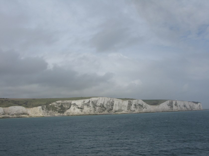
Calais is the English equivalent of Dover in more ways than one – both look run down and depressed, neither is an advertisement for its country, and neither is at its best on a wet evening. Calais has the additional disadvantage of having been largely destroyed in WWII and rebuilt unsympathetically. On the credit side, however, it has Rodin’s marvellous Les Bourgeois de Calais. It commemorates an incident where Edward III had besieged Calais into submission and demanded that six leading citizens give themselves up for execution if the rest of the population were to be spared. The sculpture shows the six walking out to give themselves up.

I’ve previoudly seen the Paris version, but this version, which sits not far from where the town leaders would have walked out to give themselves up, is even more powerful. (In the event, Edward’s queen interceded and their lives were spared.

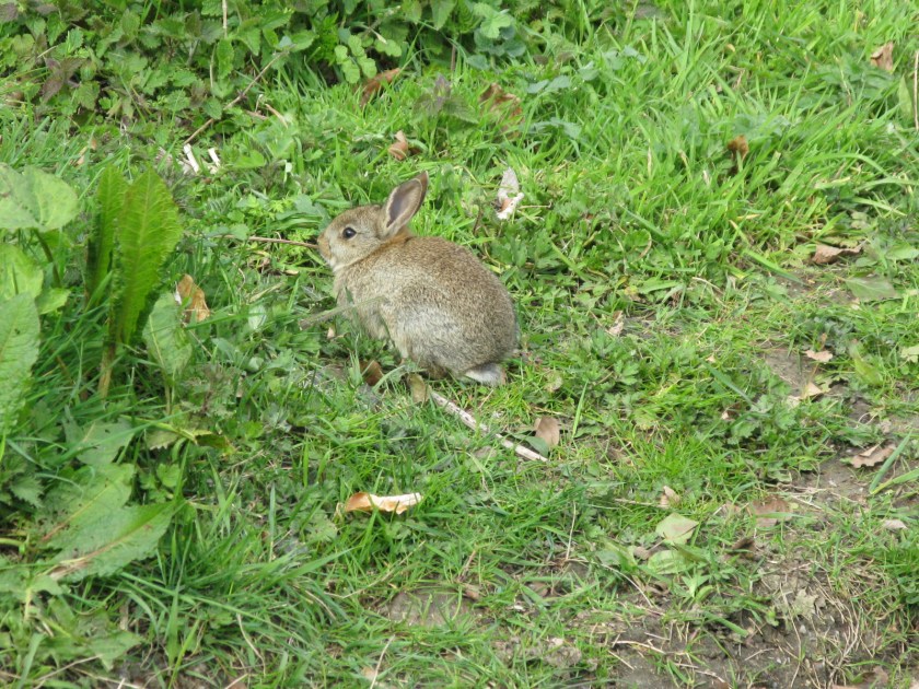
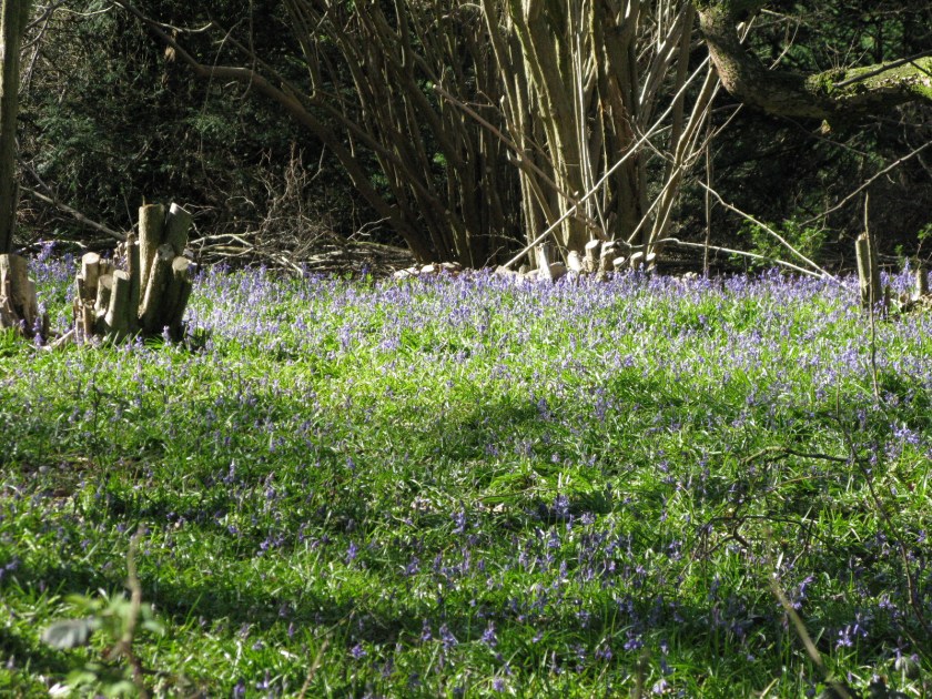
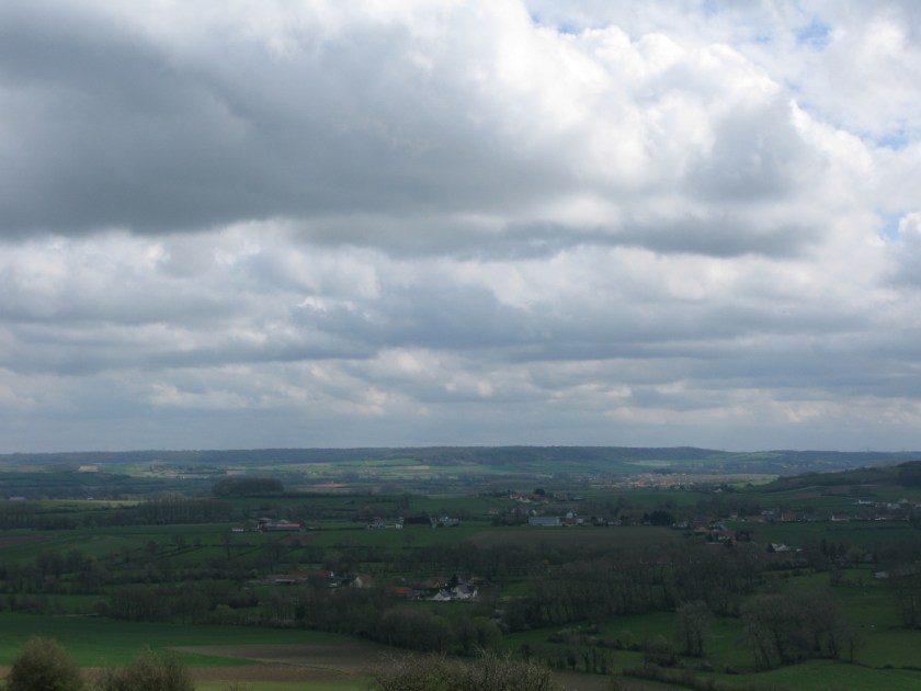
I didn’t have to go far inland before I was experiencing the familiar joys of rural France: quiet roads, washed-out colours and red tiles on buildings, gently rolling countryside, and great views from ridges overlooking the landscape.

IMG_3389

It has been eight years since I walked in France, but it’s all comfortably familiar. It’s good to be back.

Day 37 Route: Calais to Licques via Via Francigena. Terrain: paved and unpaved tracks through forests and fields. Weather: mostly overcast with light showers. Daily distance: 27 km/16.7 miles. Cumulative distance: 865.5 km/536.6 miles. Accommodation: cabin at Les Trois Pommiers, Licques.

April 14: The last English day

My time in Canterbury was overshadowed, literally and figuratively, by the Cathedral: literally as I spent most of my time in or near the Cathedral, figuratively because of the significance of pilgrimage to, and inside, the Cathedral.

Today we tend to think of cathedrals as places of worship. They were, but they were also, to a greater or lesser extent, places of pilgrimage. All cathedrals would have relics to add to their prestige and encourage the faithful to visit. Canterbury, however, had relics that were both highly prestigious and indubitably genuine: there could be disputes over who had the real ring finger of Saint Peter or fragment of the Cross, but there could be no dispute that St Thomas a Becket had been murdered at Canterbury and his body and shrine was there. So Canterbury became a centre for pilgrimage, both as a destination in itself and as  starting point for the pilgrimage to Rome.

There is a physical reminder of this at the Pilgrim Steps In the cathedral. These steps lead up to the area behind the altar where the shrine to St Thomas a Becket was located.

image

If you look closely, you can see how worn and polished they, in mute witness to all of the pilgrims who have climbed them over the centuries. As I went up them, the awareness of those who had done so before me was almost overpowering.

Day 35 Route: Canterbury to Dover via Via Francigena. Terrain: field paths, tracks, minor roads. Weather: sunny and warm. Daily distance: 31.1 km/19.3 miles. Cumulative distance: 838.5 km/519.9 miles. Accommodation: Westbank Guest House, Dover.

April 12: The first Canterbury rest day

I had not planned to blog today, but I have to write about my favourite hotel of the trip so far.

The Cathedral Gate Hotel is the sort of place that you couldn’t make up. It, or its predecessors on the site, have been hosting Canterbury pilgrims for almost 600 years. It is right beside the main entrance to the cathedral precinct, although you have to look hard as – in true Harry Potter fashion – there is nothing to see but a discreetly signed doorway.

IMG_3274

To get from that doorway to my room (“Nightingale”), which is on the second floor, can be done in a few different ways, all of which involve taking about six flights of stairs, umpteen turnings, and an open walkway across a rooftop (umbrellas are provided). Once in the room, the floors are pitched so sharply that I had a near-disaster when a cup of coffee placed on a highly polished bedside table started sliding abruptly sideways toward the table edge (the staff tell me that part of the reason for the tilt is supposedly that, when Henry VIII built the main cathedral gate in the 1500s, he simply had the house pushed sideways to make room).

It’s quirky. But the staff are delightfully friendly and helpful, my bed is a massive fourposter, and this was the view I saw through my window when I woke up this morning.

IMG_3268

I really, really like this hotel.

Day 33 Rest day, Canterbury.


April 11: The Canterbury approach day

I usually have mixed feelings on the last day of a long walk. While t0day was not a last day, it had something of that flavour as it marked the end of my warm-up walk, so to speak, along the E2. After a couple of rest days in Canterbury, I’ll be starting the Via Francigena itself later this week.

On one hand there’s a sense of achievement. At the same time, there’s a sense of sadness, almost of loss. I think perhaps it comes from the realization that the challenge, which is a significant part of the motivation for a walk like this, won’t be there any more. I’ll have my memories of the walk, good and bad, and I’ll know I succeeded at something difficult, but the challenge will be gone.

These mixed feelings made for an odd day’s walking. My first glimpse of Canterbury Cathedral came about half-way through the day (you can see the main tower, Bell Harry Tower, framed between the two prominent trees).

IMG_3257
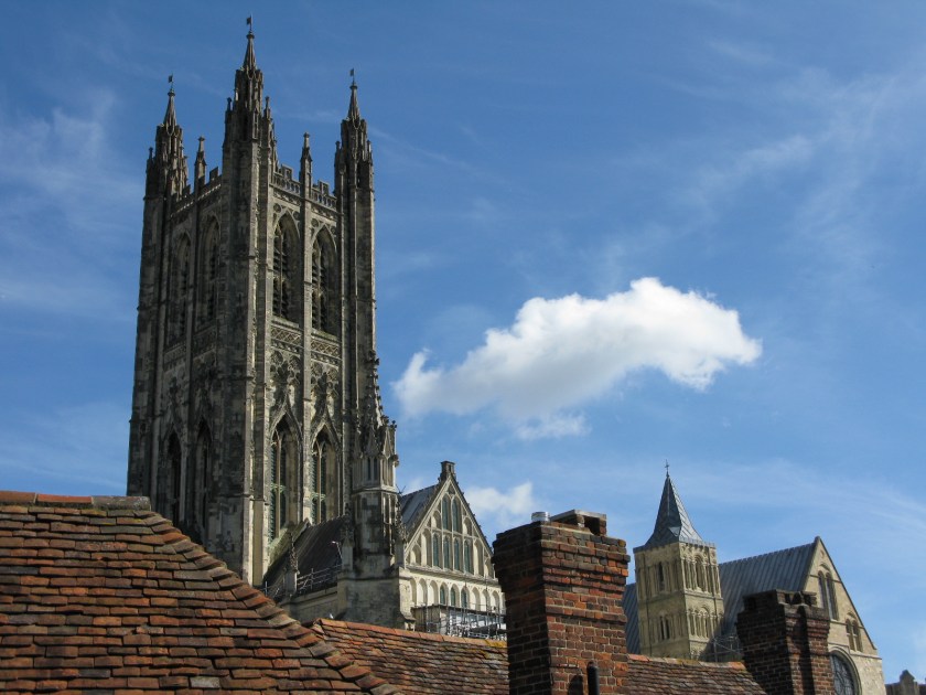
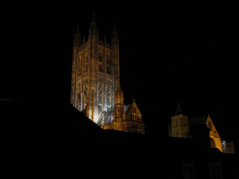
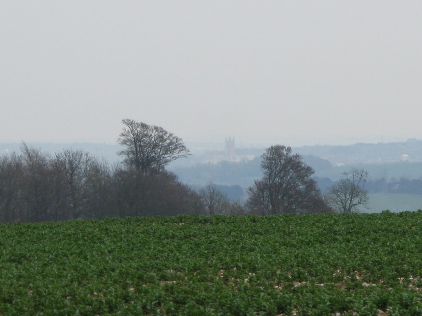
From then on, while my pace seemed to slow, my progress across the map seemed to go more and more quickly. It seemed like almost no time before I was turning in for the night immediately below that tower.

IMG_3266

When I started off, the idea of actually walking to Canterbury from my home in the North seemed so preposterous that I was reluctant to say it when people asked where I was going. And now I’ve done it. It still hardly seems real.

Day 32 Route: Charing to Canterbury via North Downs Way. Terrain: field and woodland paths and tracks. Weather: initially sunny, later overcast and eventually raining heavily. Daily distance: 32.9 km/20.4 miles. Cumulative distance: 807.4 km/500.6 miles. Accommodation: Cathedral Gate Hotel, Canterbury.

April 10: The race day

Dinner is a great motivator.

Or at least it was today. Today was the third of four long days that should bring me to Canterbury tomorrow evening. Usually long days aren’t a problem, particularly now we are into summer time and the evenings are getting longer. Today, however,  the pub I was staying at stopped serving food at 5:00 p.m., and there were no alternatives as it was out in the middle of nowhere. So, I had to force my pace all day.

There were two bits of good news. First, I arrived in plenty of time for dinner. Second, I did so with relative ease. After a month of walking, it’s good to know that my stamina is improving.

I saw my favourite pub sign of the trip so far today.

IMG_3252

As well as the Easter Bunny’s little brother – or perhaps it was Fiver from Watership Down.

IMG_3255

Although the real Watership Down is well west of here, in Hampshire, the countryside is similar and I’ve seen several large warrens.

Day 31 Route: Kit’s Coty to Charing via North Downs Way. Terrain: field and woodland paths, tracks. Weather: mostly sunny, warm. Daily distance: 30.4 km/18.8 miles. Cumulative distance: 774.5 km/480.2 miles. Accommodation: The Bowl, near Charing.

April 9: The wet start day

It was raining quite hard as I had my full English this morning.

Generally I don’t mind rain when it starts as I am actually walking. I have a good rain jacket and rain pants (although I actually haven’t needed the rain pants yet). Rain, and particularly low rainclouds, can make navigation difficult up on the moors because it obscures what landmarks there are, but it doesn’t cause those problems in the cultivated landscape I am passing through at the moment. In fact, most days on this walk so far I haven’t bothered to check the weather forecast before the day’s walk: the weather doesn’t change my walking plans, or what gear I’m carrying, so there’s not much point.

But setting off in the rain seems different, somehow. It’s one thing to be caught by weather along the trail: you gear up and keep going. It’s harder to commit to stepping out into the rain. It’s probably just a vestige of my urban background telling me that rain is something to avoid, rather than put up with.

Fortunately the rain tapered off shortly after I started walking, giving great views along the line of the Downs and into the lowlands below.

IMG_3241

And, along the trail, more signs of spring – bluebells in bloom.

IMG_3242

Day 30 Route: Kemsing to Kit’s Coty via North Downs Way. Terrain: tracks and field paths. Weather: wet initially, clearing later. Daily distance: 35.3 km/21.9 miles. Cumulative distance: 744.1 km/461.3 miles. Accommodation: The Lower Bell, Kit’s Coty.

April 8: The meridian day

I reached another milestone today.

image

Not only does this sign mean that I am now in the eastern hemisphere, it also means that I am past London and rapidly (well, so to speak) approaching Canterbury and the end of the England section of my walk.

It also got me thinking about navigation, and more specifically about maps. Walkers in the UK are fortunate to have the Ordnance Survey, which publishes incredibly detailed maps of the whole country. The maps show the physical features of the landscape: contours, watercourses, woodlands, and so forth. They show human alterations to the landscape, such as roads, buildings, field boundaries, and transmission lines. They also indicate rights of access to land, which is crucial information for walkers as it shows where you’re allowed to go. This screeshot shows the OS mapping for the first few kilometres of my walk:

image

I started near the centre of Settle, at the left on the map, and followed the public footpath (the green dashed line with green diamonds) marked “Dales High Way” up then left to right across the map. I’ve been using maps from the same series since. They are sufficiently detailed that I don’t need a guidebook or a GPS – knowing the route I want to take, I just have to relate the information on the map to the features on the ground.

I printed out the maps from Settle to Dover on letter-size sheets of paper before I started the walk. It worked out to 105 sheets in total. It seems hardly credible that I only have a few sheets left.

Day 29 Route: Godstone to Kemsing via North Downs Way. Terrain: field, forest and downland paths. Weather: mix of sun and cloud. Daily distance: 29.7 km/18.4 miles. Cumulative distance: 708.8 km/439.6 miles. Accommodation: Park Lane B&B, Kemsing.

April 7: The dreary day

The weather today was the dreariest since the start of the walk: no heavy rain, but an intermittent drizzle that began as I left my hotel and continued on and off throughout the day.

Putting on my raincoat got me thinking about how little has changed between how I am equipped and how a pilgrim seven hundred years ago, or come to that a Roman legionary two thousand years ago on the same track, would have been equipped: sturdy footwear, an outer garment to keep out the weather, a warm layer, something to use as shelter, some money, some food and drink, a few personal effects, and a stout stick. The materials have evolved, but the basic needs haven’t. The priorities haven’t changed either: not getting lost, staying warm and dry, and reaching the day’s destination safely before nightfall. There’s an attractive simplicity to walking as a means of travel – you concern yourself with those most basic priorities.

So, a dreary day, but one bookended by two pleasant surprises. First, shortly after setting off, I came to a stream crossing with a set of stepping-stones – once again, something that a pilgrim seven hundred years ago would have recognized as easier than building a bridge,  but rather less common nowadays.

IMG_3220

Second, coming down a narrow path near the end of the day, I found myself face to face with a fox just a few yards down the trail. No picture, sadly – by the time I got my camera out, he had disappeared.

Day 28 Route: Dorking to Godstone via North Downs Way. Terrain: tracks through fields, woods and downland. Weather: overcast, intermittent rain. Daily distance: 25.5 km/15.8 miles. Cumulative distance: 653.6 km/405.2 miles. Accommodation: Godstone Hotel, Godstone.